1
2
3
4
5
6
7
8
9
10
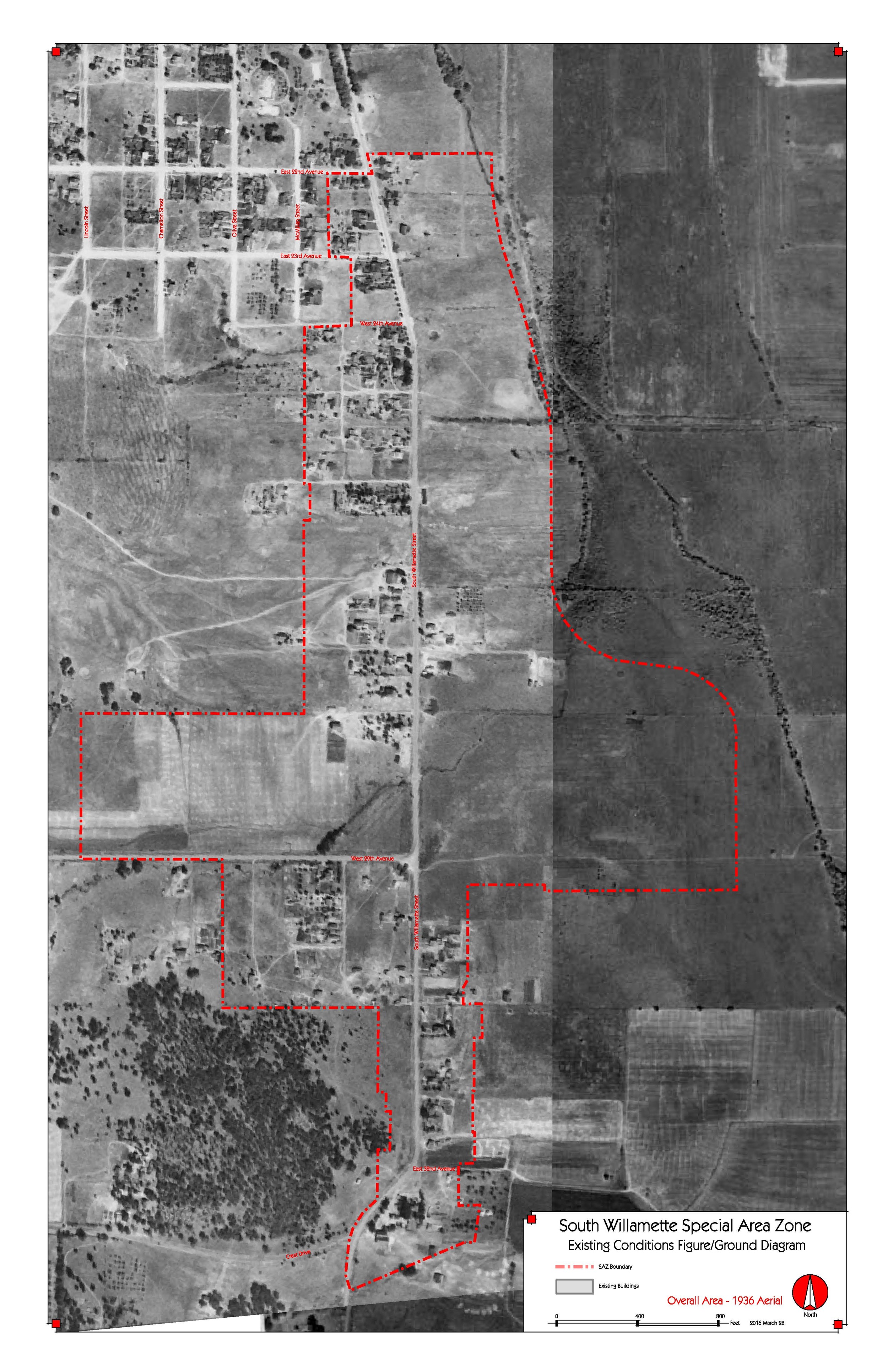
1936 Aerial
Shows South Willamette and West 29th Avenue with just the beginnings of development and most of the land as grazing and pasture land. (USACE Aerials)
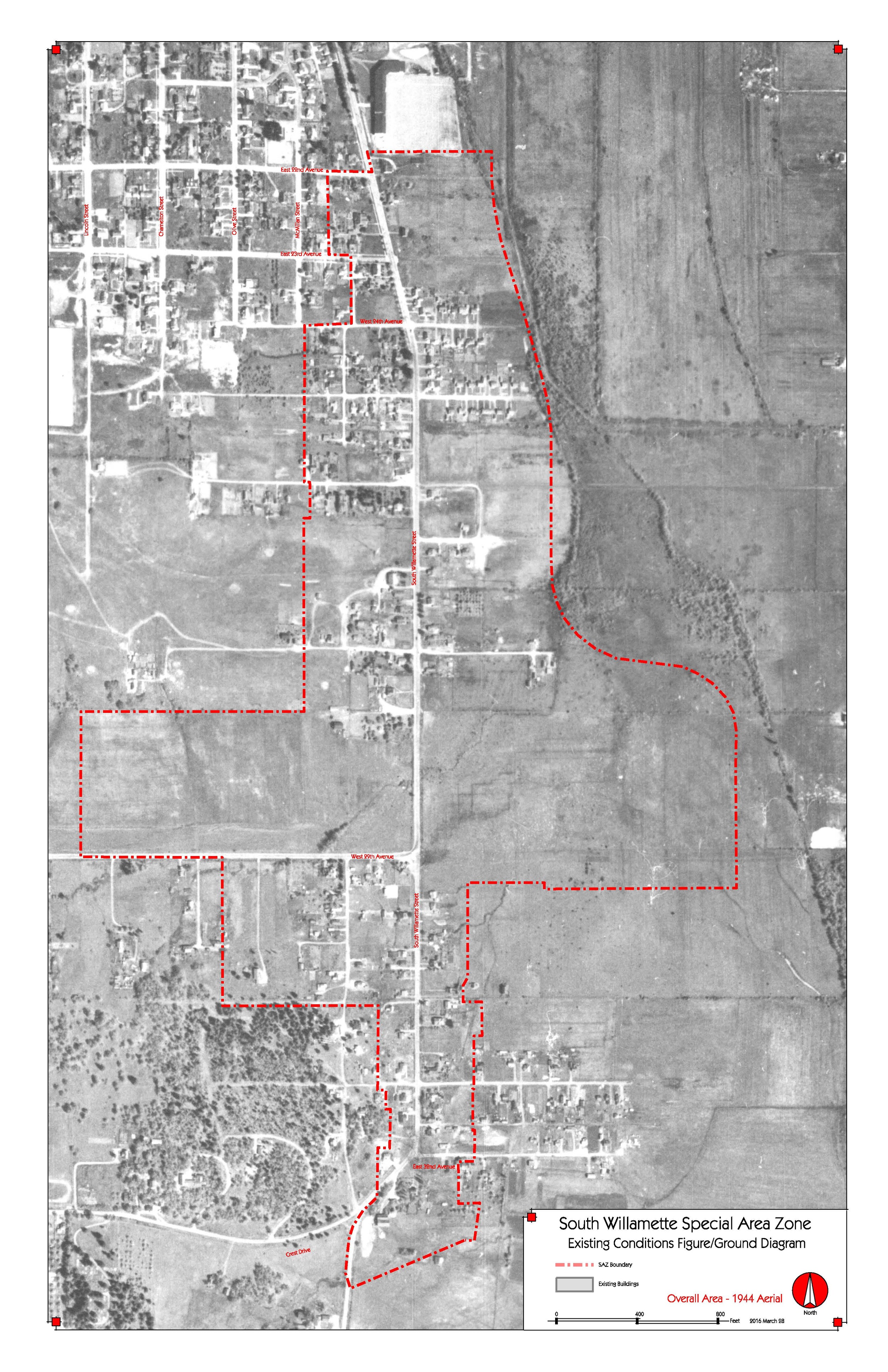
1944 Aerial
Development is starting to fill in on College Hill and south of 29th Avenue, but much agricultural land remains. (USACE Aerials)
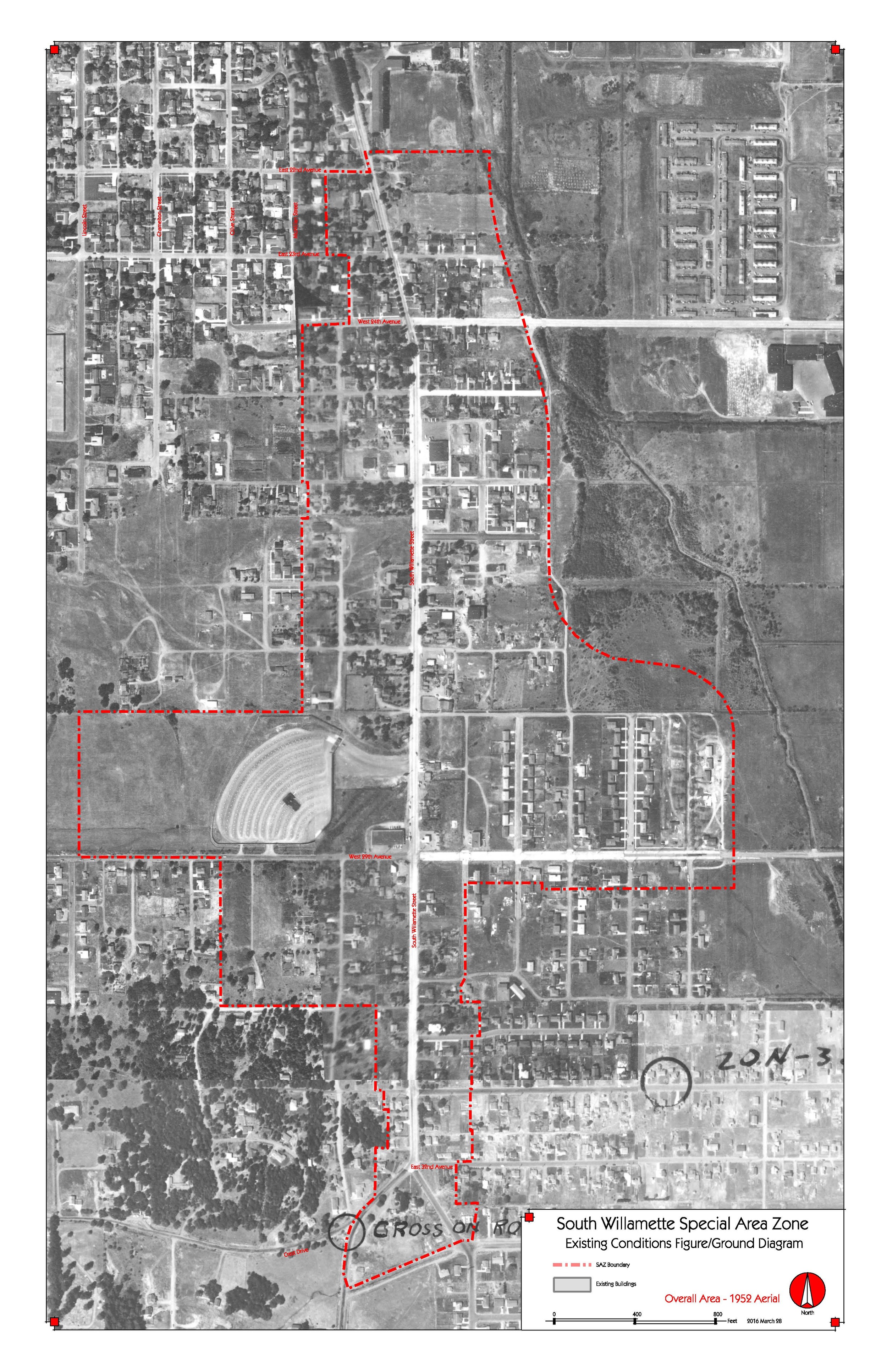
1952 Aerial
Many of the streets in the neighborhood area are now built and developers are building homes; the drive-in theater is in the northeast corner of South Willamette and West 29th Avenue. (Cascade Aerial Contractors)
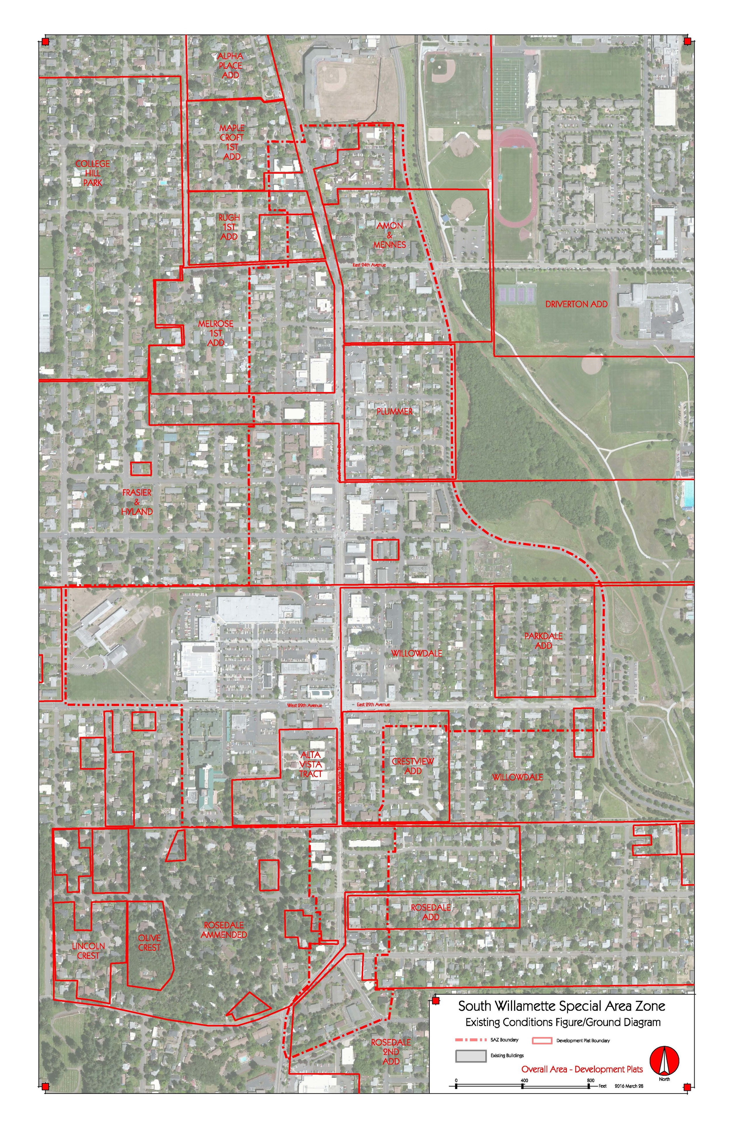
Development Plats
Shows the named Development Plats wherein developers applied for planning permission to develop each section of the neighborhood (from City of Eugene website).
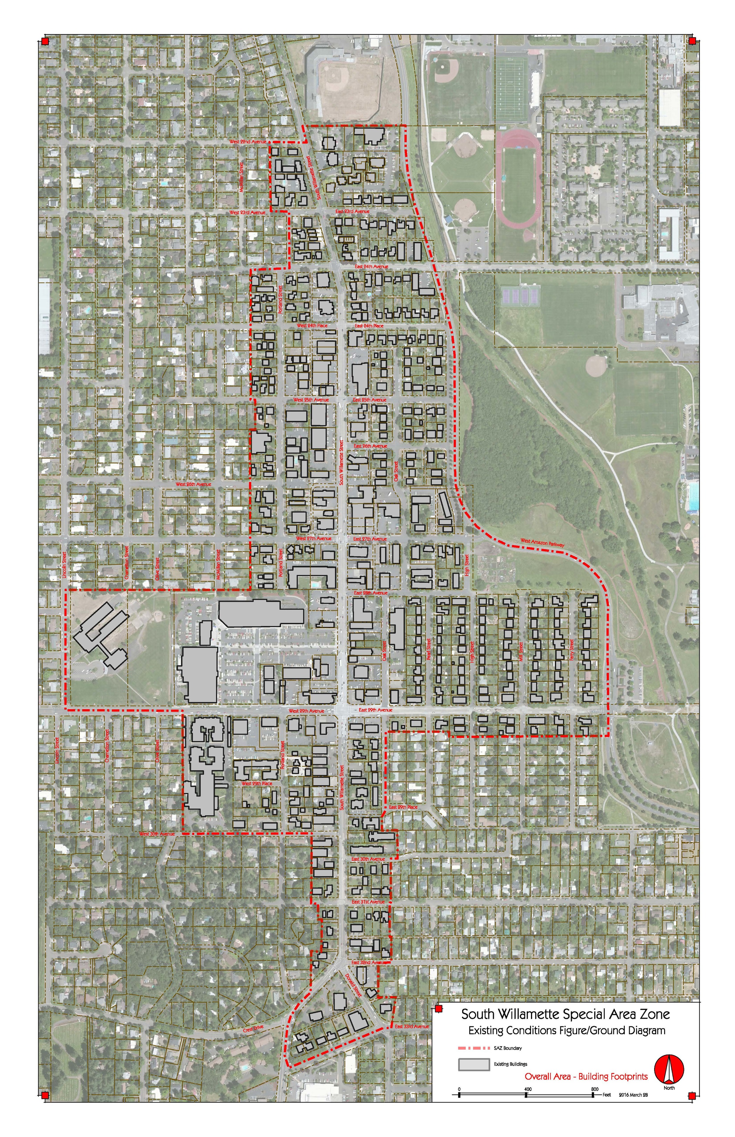
Overall Building Footprints
Approximate building footprints on color aerial imagery (ESRI World Imagery)
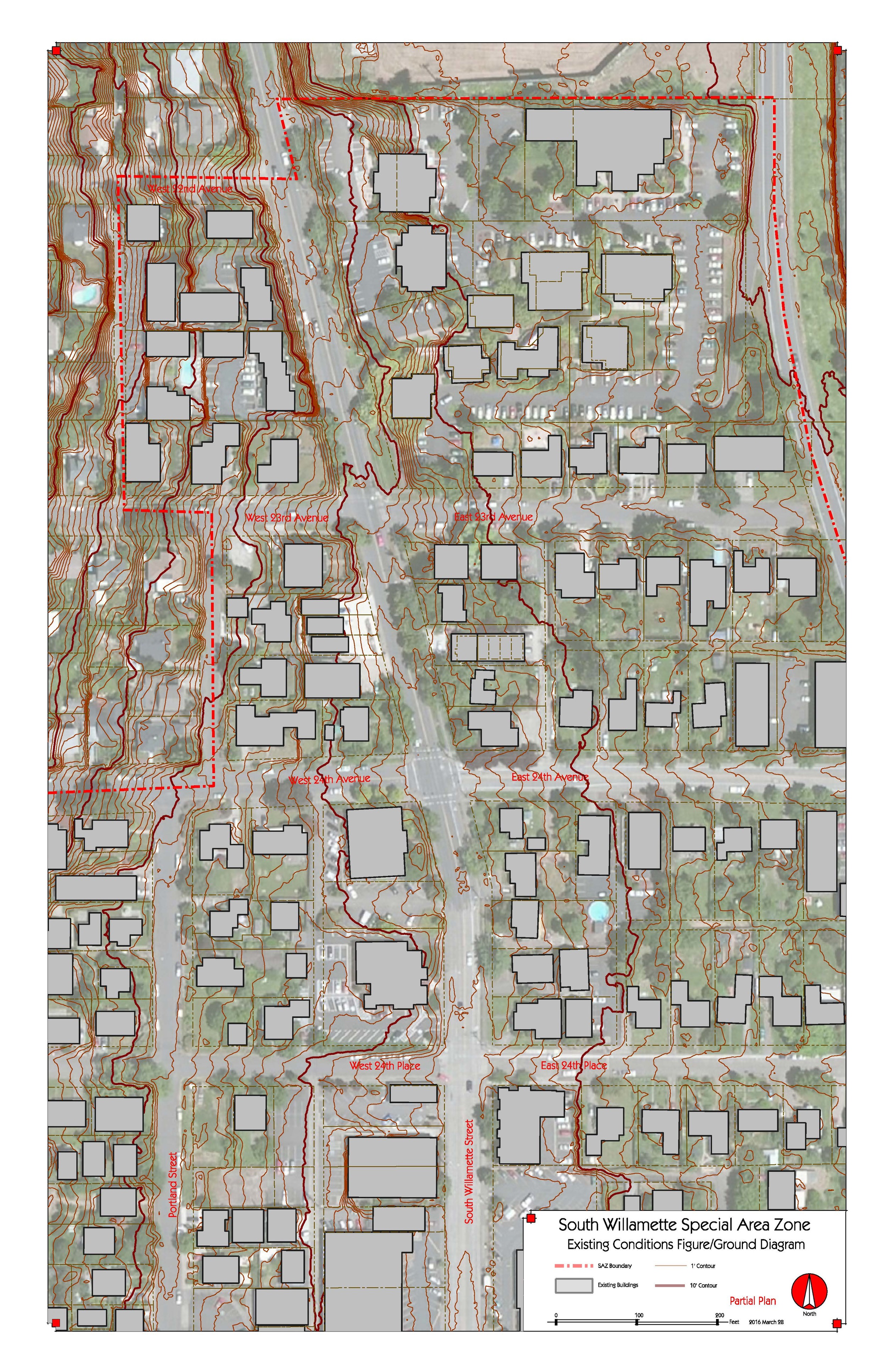
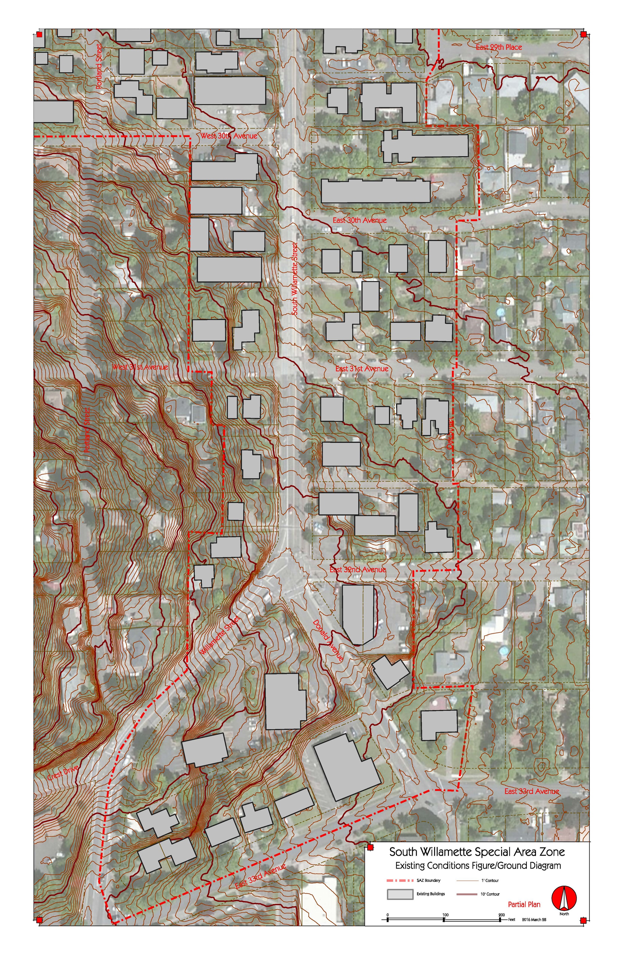
Willamette Street Detail Sheets
Show building footprints on a color aerial with topographic contours.
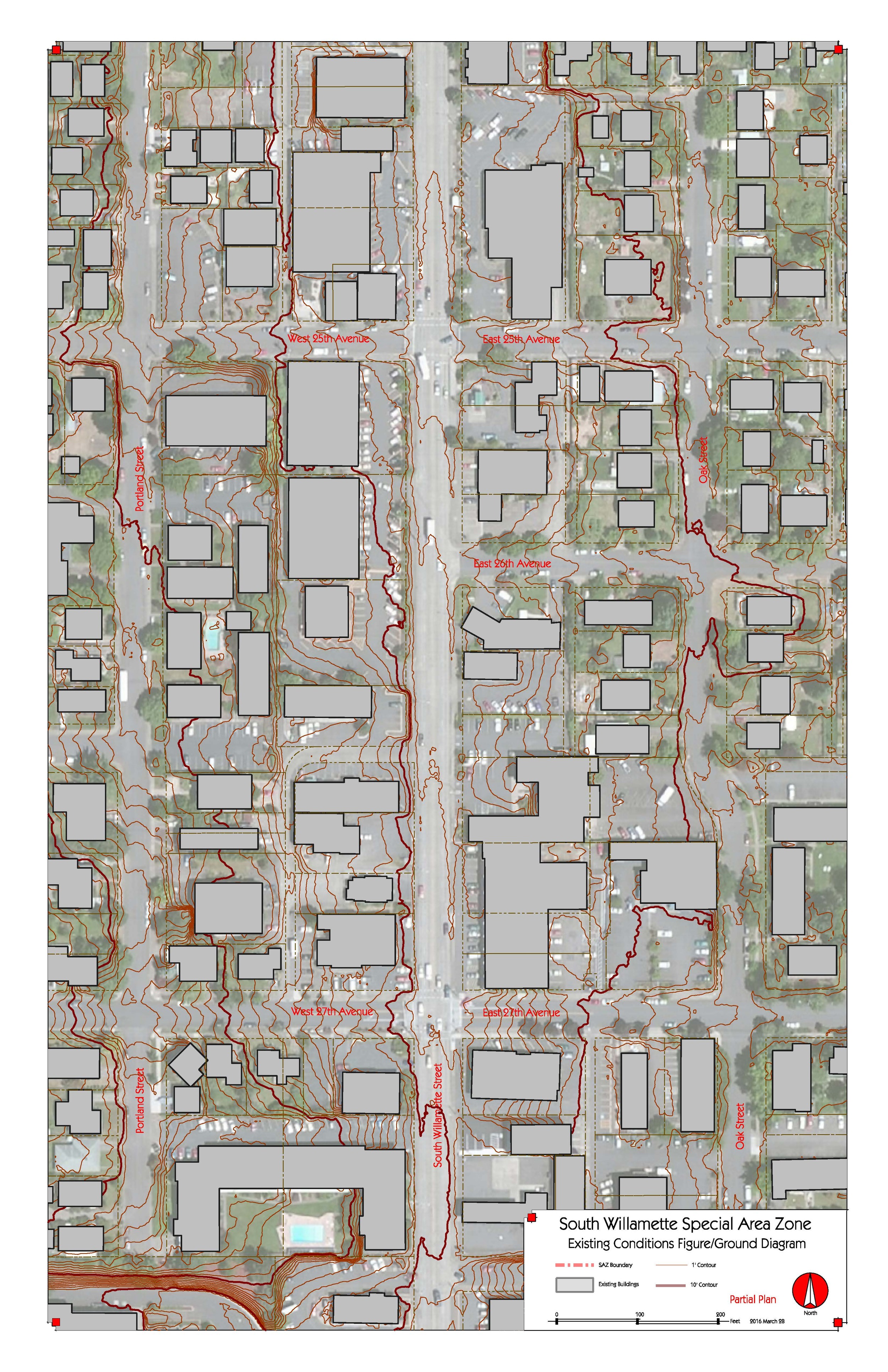
Willamette Street Detail Sheets
Show building footprints on a color aerial with topographic contours.
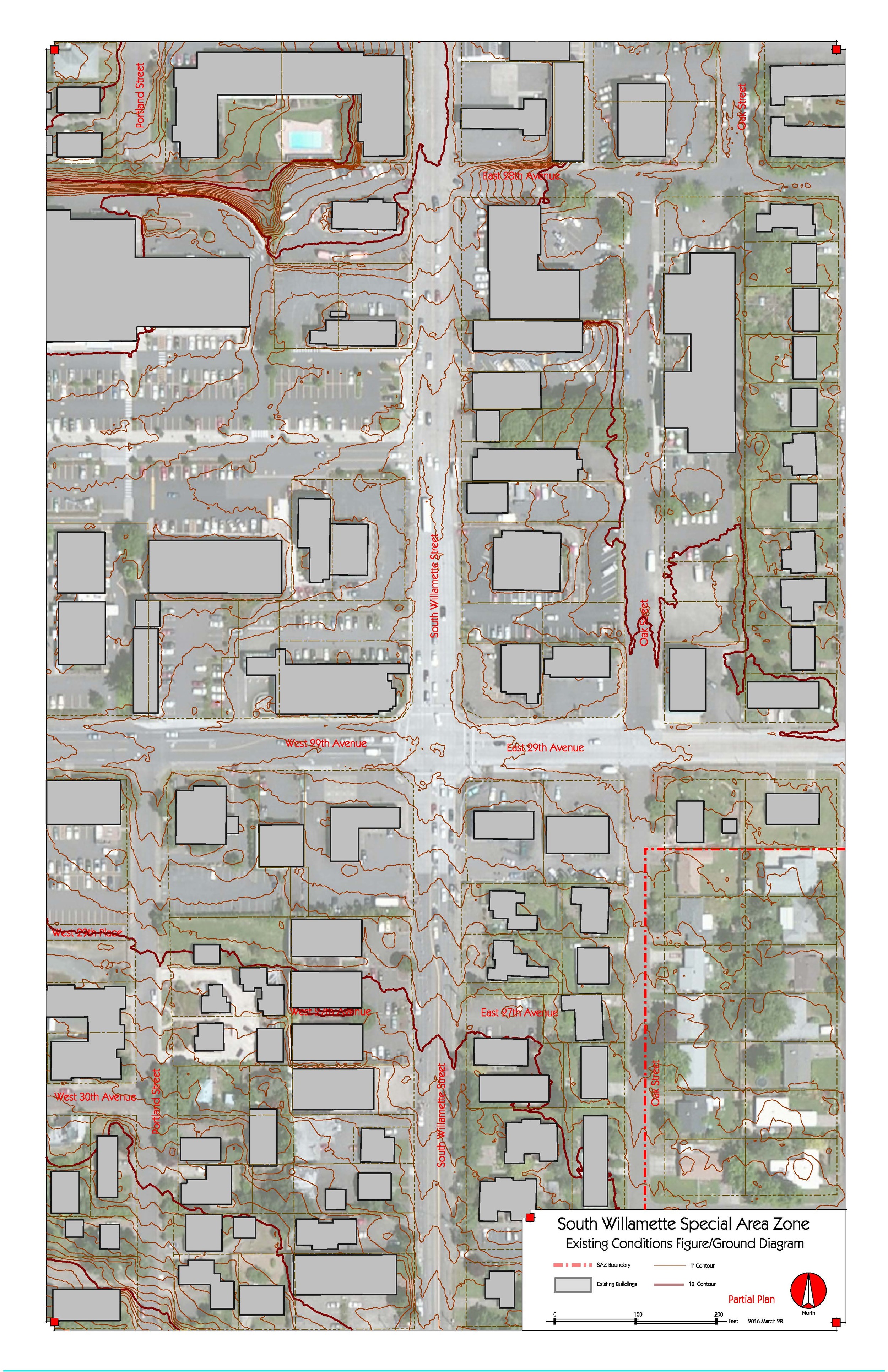
Willamette Street Detail Sheets
Show building footprints on a color aerial with topographic contours.
Willamette Street Detail Sheets
Show building footprints on a color aerial with topographic contours.
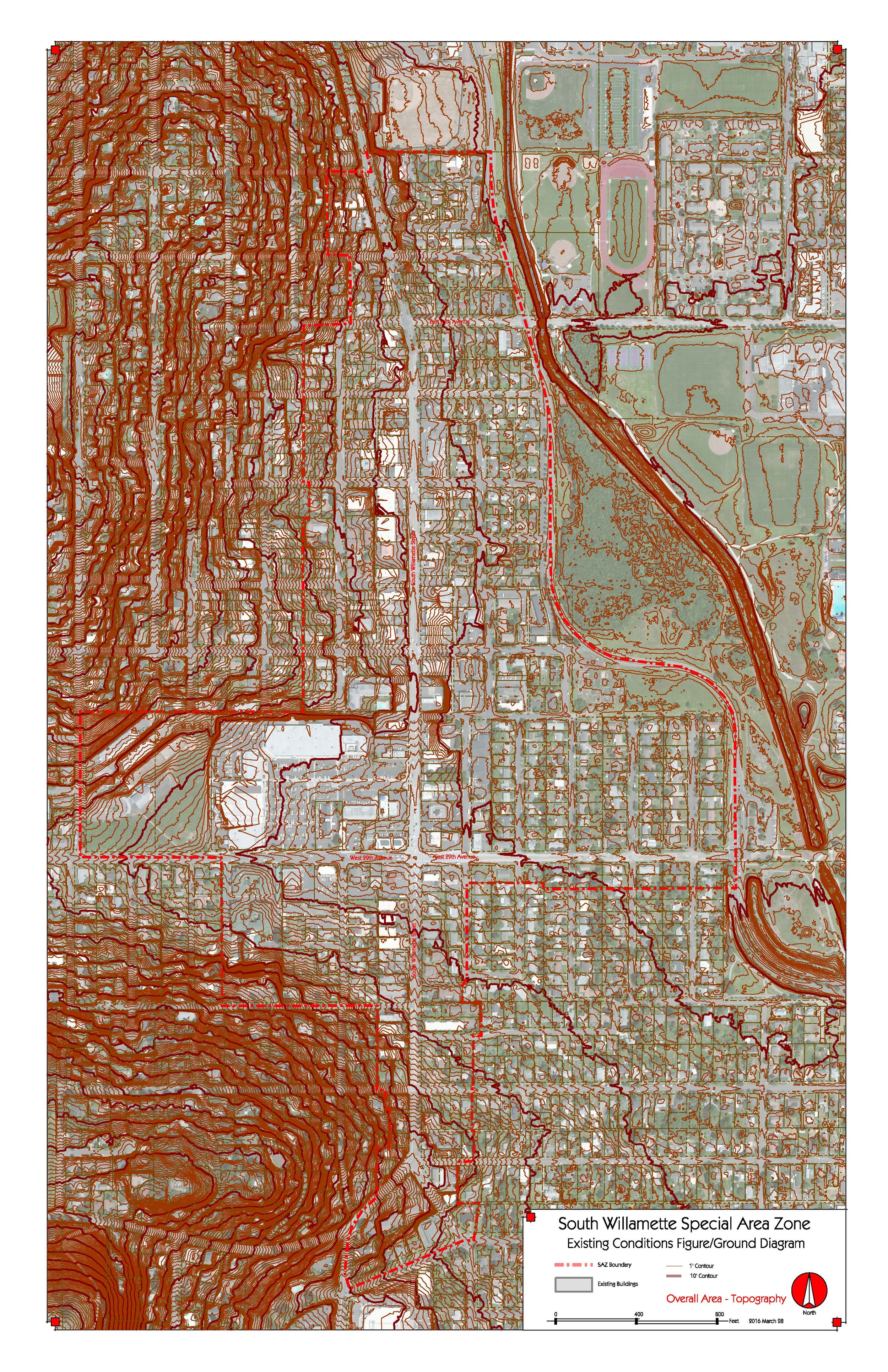
Overall Topography
One foot contours, showing College Hill and the lower edge of the South Hills and the flat land along Amazon Creek. (Lane County LIDAR)